Maps Integration
Planfix can display addresses and routes on maps. Addresses (or object names) are entered as text in location custom fields. Objects can be displayed on a map in task cards, contact cards, task filters, and contact filters.
Supported maps
Currently, addresses on Google Maps and OpenStreet Maps are supported. The Google Maps API is used to process text addresses and translate them into geodata for display, so you need to have a Google account in order to connect the map integration.
Enabling integration
- Go to Account management / Integrations / Maps
- Click Enable integration
- Select one of the supported maps and enter the Google Geocoding API Key obtained by connecting to the Google Maps API
- Save your settings
Working with maps
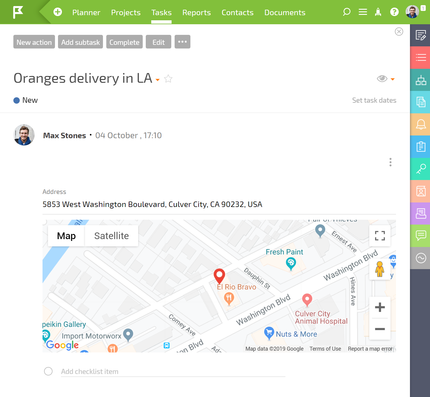
- After enabling the integration, addresses and object names entered in location custom fields will be displayed on the selected map in addition to being displayed as text:
- Task and contact filters containing tasks with location fields can have this data displayed on a map. To do this, switch the filter display view to Location:
 Important: To have the data displayed on a map, the field with the object's location data must be in the list of fields displayed in the filter.
- Task or contact data in the filter can be displayed as either a pin on a map or as a route. You can switch between these two options here:
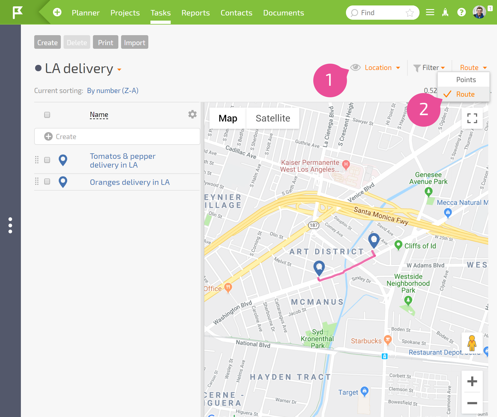
This option works only with Google Maps; OpenStreetMap offers a static map.
- The order of the points on the map route is determined by the order of the tasks/contacts in the filter.
Please note
Currently, only one map service can be connected.